
Field report
Rabaul: our first deployment
Simpson Harbour, Papua New Guinea, 4 to 22 October 2026. Drone, sonar, divers and ROV over one of the most concentrated wartime wreck sites in the world.
Tavurvur and Simpson Harbour from the air, Rabaul, October 2026

Why Simpson Harbour
More than 50 wrecks in an active caldera and a working harbour
Rabaul sits at the eastern end of New Britain, inside the flooded remains of a volcanic caldera. During the Second World War it was the main Japanese naval and military base in the South Pacific, and the fighting left the harbour floor scattered with more than 50 sunken ships and aircraft.
Eighty years on, those hulls are still there. The harbour is on the Pacific Ring of Fire, with Tavurvur active on its shore, so the wrecks sit in a seismically live setting. The port is in daily use and is being rehabilitated, which puts dredging and anchoring over the same seabed.
That combination made Rabaul the right place for our first field deployment: a concentrated, ageing pollution risk, a community that depends on the water, and a chance to replace inference with observation.

History
A town that has been rebuilt more than once
Rabaul was bombed, occupied, fought over and, in 1994, buried under ash when Tavurvur and Vulcan erupted together. The memorial in the old town records that history in the words of the people who lived it.
Many of the wrecks in the harbour are war graves. We treat them that way. Nothing is touched or recovered: the structures and the remains they hold stay where they are, and our work is to look, measure and report.

What we did
Nineteen days on and under the water
The deployment ran from 4 to 22 October 2026. We worked from a small boat with local crew, moving from the air to the surface to the seabed as the picture built up.
- Drone survey Aerial passes over the harbour and the caldera rim to map the working areas, anchorages and shoreline.
- Sonar survey Sonar transects across the harbour to locate targets, measure them and plan the dives.
- Diver inspection Dives on the shallower wrecks to record the condition of hulls, decks and visible structure.
- ROV inspection A remotely operated vehicle on targets beyond comfortable diving depth, recording video for the survey report.
What we saw
Six views from the harbour floor
A selection from the dives and ROV runs. Locations are described by general area only.
-
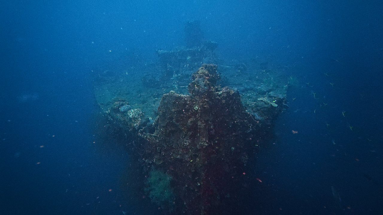
A bow still standing
The forward section of a merchant hull, upright on the seabed and heavily encrusted, with the stem line still clear.
-
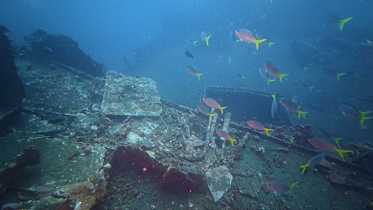
A deck become reef
Collapsed deck plating carrying dense coral and sponge growth, with schooling fish over the structure.
-
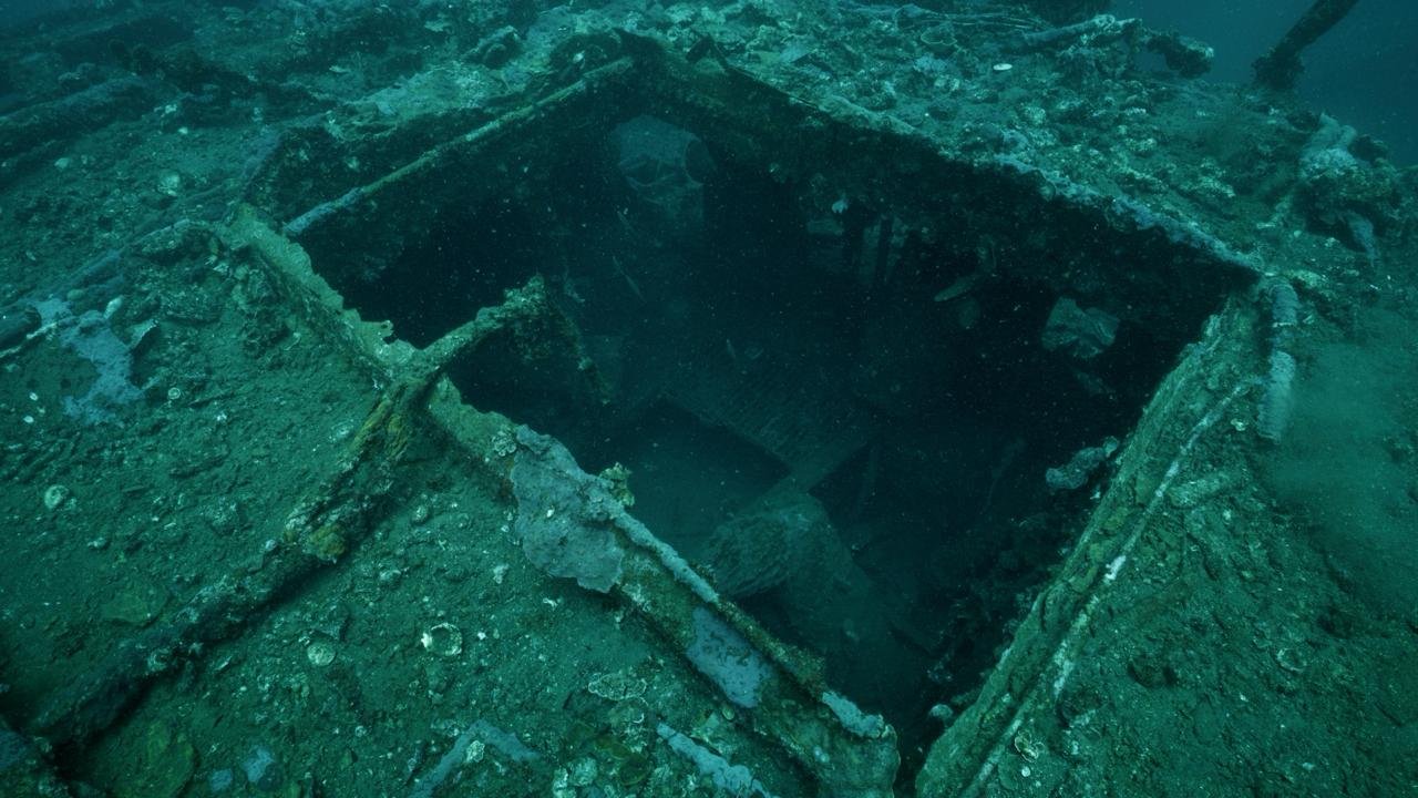
Inside an open hold
Looking down through a hatch into a hold, the coaming and beams still standing and the space below silted and dark.
-
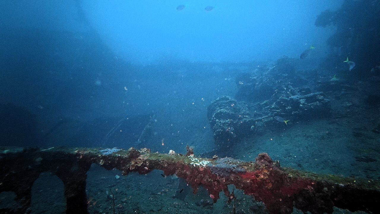
Rails and fittings
A ship's rail in good definition under red encrusting growth, the kind of detail that lets a wreck be identified from the record.
-
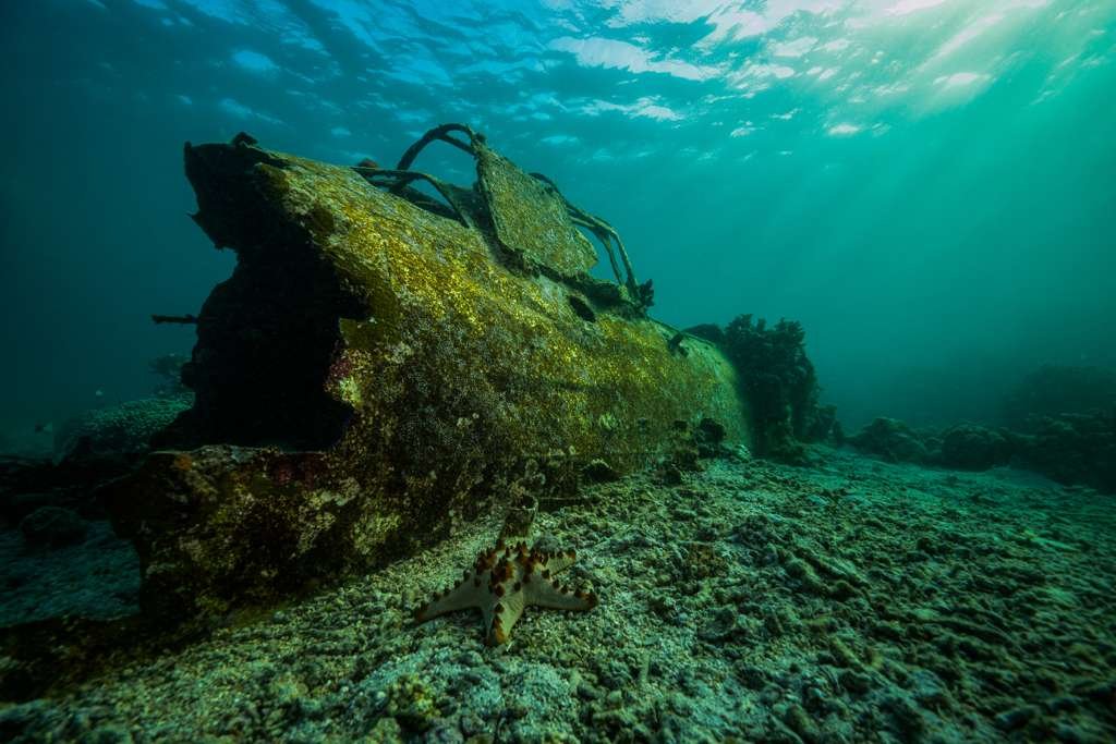
A fighter on the reef
The fuselage of a wartime fighter in shallow water, colonised throughout, with the reef growing back around it.
-
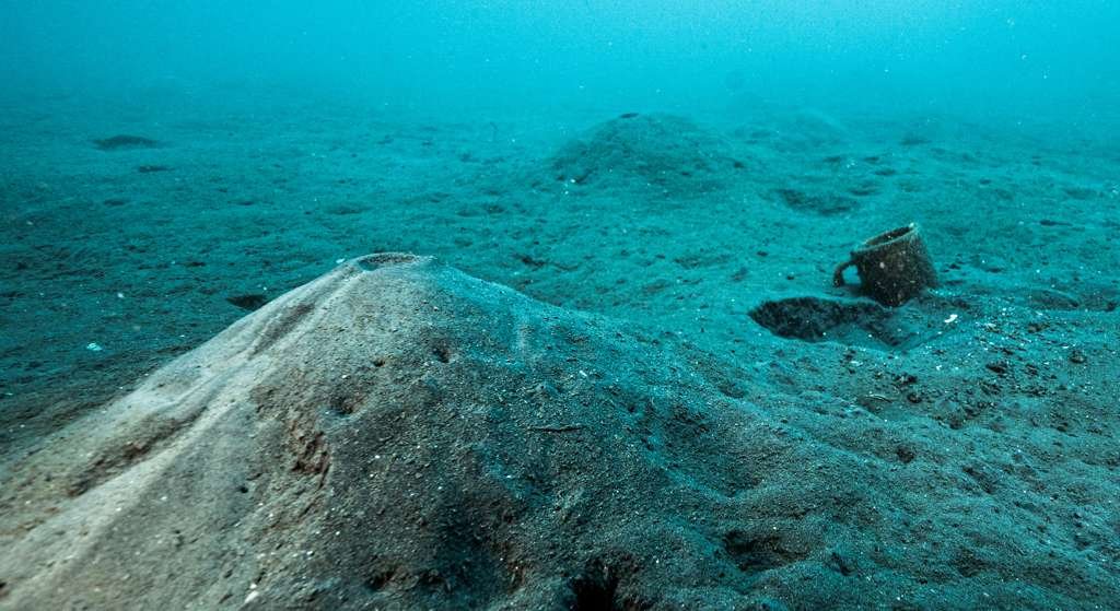
Ash over everything
Volcanic ash covers the harbour floor and buries much of what lies on it. Small objects, like this cup, sit on the surface of it.


Proposed next steps
A survey report first, then a proposal for the harbour
The first output is the survey report: measured positions, observed condition and imagery for each target, written so that the authorities responsible for the harbour can act on it. The findings also update each wreck's assessment in the Guardian platform.
Beyond the report, we are preparing a proposal for marker buoys over the wrecks most exposed to anchoring and dredging, and for monitoring buoys that would give early warning of a release. Both are proposals at this stage and depend on the agreement of the relevant authorities.
Talk to us about a survey in your waters
Community and dive partners
Salt PNG: the people who dive these wrecks every week
Salt PNG, the dive operator in Rabaul, know the harbour better than any archive. They put us on targets, read the conditions and dived alongside us, and we are continuing to work with them. Divers who visit these wrecks are also the people most likely to notice a change: a new sheen, a collapse, an exposed shell.
Guardian gives them a way to report what they see, with photographs, so that an observation on a Saturday dive reaches the platform the same week.
Report a sightingSupport the next phase
The survey report is in preparation. Sponsors fund the analysis, the return visit and the first marker buoys.